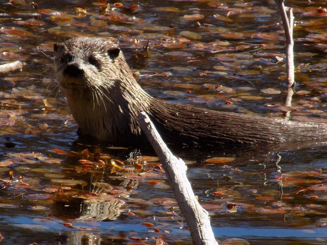
These juvenile otters were in a marsh about 1 mile from Penner Lake in late 2018. I had never seen otters at this elevation before.
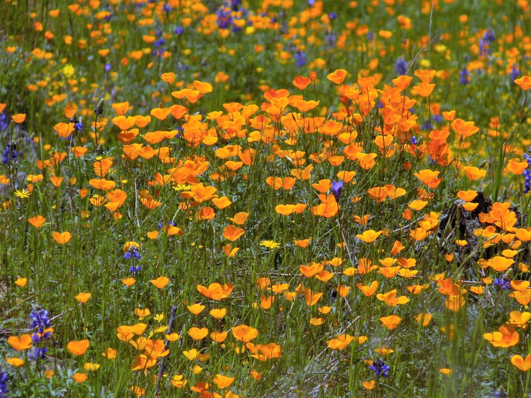
Second photo: spring wildflowers on the Windy Point trail
I-80 Hikes Auburn to Truckee
The Trails Less Travelled
Version 2.1 out September 2019
Version 2.2 out November 2020
Day Hikes along Interstate 80, Gold Country to Truckee California
Emphasizing Trails Less Travelled, Extensions and Cross-Country
By Roger Mann
2017, 2019
© 2015, 2017, 2019 Roger Mann
As of 8/7/2022 available on Amazon, again, here.
https://www.amazon.com/I-80-Hikes-Trails-Less-Travelled/dp/1542488656
This web page provides updates and corrections to the book I-80 Hikes The Trail Less Travelled.
Order the book here: https://www.amazon.com/I-80-Hikes-Trails-Less-Travelled/dp/1542488656
First, here's the safety disclaimer.
DISCLAIMER/ADVISORY
The author assumes no liability regarding any information or misinformation that may be provided by this website. The author makes no representations regarding the safety of hiking, or the reliability, accuracy or completeness of information provided. By using the guide and this website, you are assuming all risks. My descriptions may not be entirely accurate. If you think I made an error, please let me know.
This website is a supplement to the book. The book includes important safety information and advice that is not repeated here. Never forget, you are on your own and responsible for your own safety out there. Be safe and don't take chances. Safety information has been added in Version 2.
Most of the hikes are for experienced hikers. Some of the hikes are not well-marked, and many include hiking off-trail. I use the term bushwacking for off-trail hiking. You should not hike off-trail by yourself, especially where you have no cell phone reception. Hikes with bushwacking segments are not recommended for solo walks because there are normally few or no people around. For hike segments that are on-trail, it’s still easy to get lost. Trails may be difficult to follow, what appears to be trail may not, and trail junctions are often not marked. If you must hike alone, leave a plan and directions with someone who can report you missing.
No matter what happens, do not panic. Panic is a cause of many backcountry disasters.
Below, I provide updates that are not described in the most recent version 2.2 of the guide. Then I describe the I-80 Hikes book. Then, all updates since the first version of the book are provided for each hike in the book. These updates provide important information about changing trail conditions, so check before you hike. Finally, I describe some loop hikes near South Lake Tahoe that are not in the scope of the book, and I discuss mileage estimates.
Since 2017, fires, timbering and access changes have impacted hikes in the Auburn to Truckee region. The book is not being updated. This website will be updated with new information as it becomes available.
Updates 2022
May 2023
I am moving to South Lake Tahoe. Since I will be outside of the scope of the hiking guide I expect to make few of any updates in the future. I'll really miss the foothills region but new adventures must begin.
April 2023
The unprecedented winter will affect our hiking season through summer. There is lots of deadfall in the foothills region, especially in the 2,000 to 4,000 ft elevation range. Expect delays in timbered areas. The spring bloom season appears to be delayed by up to a month. At 3,000 feet, the normal peak bloom of around April 10 may be more like May 10 if it stays cool. There will be snow in the high country all summer. Look for lower-elevation south-facing areas to hike in June and early July. I expect areas around 6,000 to 7,000 feet to be mostly open by mid-July with plenty of snow remaining in shaded and north-facing areas. The higher elevations of 7,000 to 9,000 feet may be snowed in until August. All this snow means that trails may still be buried, it will be easy to get lost, and stream crossings may be challenging. Expect a slower pace. I recall in the last big year, 2019, which was not nearly as big as 2023, alpine flowers were blooming in early September. It will be interesting to see how much snow remains in the Sierra all summer and fall.
August 2022
Since spring I have been hiking mostly in areas outside of the scope of the I-80 book.
8/31/22. Hiked the Lake Valley Trail hike #16 in the book. Access to this hike was closed for a year due to construction and recommended access has changed. The only legal parking is in the Silvertip Day Use area, popular with kayakers, with a $5 fee. The book suggests that you walk from there to the hike on the paved access road to the Lodgepole Campground, maybe a short mile to the trailhead. We discovered that it is shorter and more pleasant to walk along the lakeshore headed west, then south on the metal walkway over the spillway, then descending a gravel road to the campground, then walk past a new road gate signed PRIVATE ROAD FOR SKY MOUNTAIN GUESTS ONLY, about 1/3 mile uphill on the paved road to the BONC (Bicyclists of Nevada County) signed trailhead. The Lake Valley trail climbs gradually through nice timber about 2 miles to the Mear Meadow spur road. When you descend you might enjoy a swim in the very clear and cool lake before heading home.
8/6/2022. I hiked to Frog Lake, recently purchased by the Truckee Donner Land Trust and opened to the public for day use. Information is available here. https://www.truckeedonnerlandtrust.org/frog-lake
I began at the free PCT parking area which is off the Boreal exit, then east on the frontage road. Find your way to the hiking tunnels under I-80 by walking east, staying right two times following signage to the PCT, then left on the PCT where the trail is signed "Castle Pass" to the tunnels. About 200 yards past the tunnels, turn right at the large trail map and continue about a mile to access the Warren Lake trail at a four-way junction. The Warren Lake trail climbs steadily to the Frog Lake overlook. Continue past the overlook for about a mile to a sign "Warren Lake 4" The trail to Frog Lake is the right turn, right here. The Land Trust has marked the trail with 1x4 inch posts painted red and with red paint on rocks all the way to the Frog Lake access road. The total round trip distance will be about 12 miles with a total of about 3,000 feet of vertical. The Donner Truckee website claims only 11 miles.
This distance is substantially more than a straight-line from Donner Summit because the Warren Lake trail passes Frog Lake and the Frog Lake trail circles back to the lake from the north. Frog Lake can be accessed with less miles and less vertical using off-trail routes. I am not going to recommend any off-trail route because the Land Trust might not approve, and also, the terrain is difficult and any route, hard to describe. If you have the skills and detailed topo maps you might figure it out. Start early.
Overnight camping is not allowed at Frog Lake. The Land Trust has some sweet cabin accommodations there. Visitors must hike in. Staff and workers can get to Frog Lake by road.
Also, the Truckee Donner Land Trust recently purchased and opened Webber Lake for public day use. There is a public campground and some fine but flat trails for hiking.
8/5/22. I hiked the very popular Loch Leven trail. This trail is so heavily impacted by traffic that it is reduced to a rocky rut in areas. Hikers have made secondary trail in many sections to avoid the rubble. Deadfall is not being cleared in a timely fashion. I recently backpacked in Emigrant wilderness on gorgeous trails with constructed steps where we saw no one else for days. Why can't the Forest Service improve the Loch Leven trail? I will be contacting Tahoe National Forest to complain.
April 2022
What a dry spring. Then it rained/snowed. More skiing. The rain will be a great help in reducing wildfire danger through the summer.
We hiked a few of our favorite wildflower areas in March and took just a few pictures. Tiny shriveled blooms. One interesting route was the Yuba Narrows from Black Swan, about 6 miles if you don't get lost. Due to poison oak I will not be publishing this route, but if you are interested email me at rmanneco@gmail.com.
February 2022
Late February hiked in the Weimar Institute trails. The main trails have been cleared of trees but some trail, especially the Sugar Pine trail, not so much.
February 20 hiked the Green Valley Trail from Alta. Road and parking lot are open. Reasonably clear of deadfall to the valley. Orange tape recently added in the valley will help guide your way to Joe Steiner's grave and the townsite. 2,000 plus vertical down and up in less than 6 miles.
February 13 hiked Cronan Ranch on a loop from West Ridge Trail to the South Fork American River trail to Cronan Ranch Road with diversions to the river then returning on the down and up trail. 7.5 easy miles, about 1,000 vertical feet.
Hiked in the Bear River Campground. Parking on the east end, and the trail going upstream (east) is closed due to the River Fire. Parking is available at the west end and the main "campground" trail is open and clear of debris from the Christmas storm. Without the river trail on the east end there is only about 2 miles of trail available plus the closed road going west about 1 mile to the group campground. So maybe you could get six miles as an out-and-back.
Hiked a trail listed on Alltrails as "Loma Rica Trailhead to Madrone Forest" This turned out to be an interesting trail for a couple of reasons 1) the trail is mostly on a steep north face and heavily timbered with large oak, madrone and many other species, and 2) the trail goes through an abandoned park built in art deco style and including a nice pond. Total of 4 miles includes a popsicle loop. The airport and roads are close by and generate some noise but are not often visible. We parked on Madrone Forest Roads and followed the alltrails route. The only other hiker we saw said that part of this area is slated for development.
January 2022
The holiday storms of 2021 have had a large influence on foothills trails in the elevation of 2,000 to 5,000 feet. Limbs and all tree sizes down and possibly dangerous especially if windy. Stevens trail has been cleared. Ponderosa roads, hike #1 is mostly clear. More remote trails may not be cleared for months. Can't recommend Green Valley or Euchre Bar. Cronan ranch has lots of open terrain.
Updates 2021
Version 2.2 is now available. Important updates through November 2020 are included. This section describes recent hikes and useful updates since then.
December 5 2021
Deer Creek Trail and Western States Trail east of Highway 89
We recently explored access along highway 89 south of Truckee to trails east of the highway. The Deer Creel trail shows on maps as beginning near the Silver Creek campground. One would think there would be public access. There is not. All ten or so bridges crossing to the east side of the river are impassable. They are gated and signed in rather unwelcoming terms. Where one might walk around a gate there are probably cameras and maybe worse. Don't try it. Instead, coming from Truckee, continue south past the entrance to Squawk Valley, now known as Palisades, until 89 crosses the Truckee River. Parking for the Western States trail is at the turn-out on the right just past the bridge. Park, walk under the bridge and the trail leaves the bike path on your right just as you come out from under the bridge. There is little parking at the turnout so you may have to park elsewhere and walk along 89 back to the turnout.
The Western States Trail east is a highly used trail that provides access to many miles of Forest Service trail east of 89 and north of Tahoe City. Go early and mountain bikes will be climbing with you, not so bad. Leave early and most won't be returning yet. That's also good. Otherwise be prepared to step off the trail often.
The trail first climbs for about 1.5 miles until some junctions might spread the traffic. Soon there will be a maze of trails so have a good map or better yet your gps app. You could make your way to the Tahoe Rim Trail, the Valley View Trail, or many others in this area. You could try to descend on the Deer Creek trail but, like the myriad of signs warns, there is no public access to get back to highway 89.
September 2 2021
Air quality has improved and most national forests are now open again.
Last winter, skiing on the Donner Rim Trail, I noticed a FS sign for the Slab Rock trail. I skied up a ways and turned around when I lost the trail in snow.
Lost and lesser-known trails are what I80 hikes is all about, so I googled it. Even though there is a sign, there was no immediate reference to Slab Rock. So yesterday we went to find it. We parked on Castle Pass road (must arrive early on weekends) and walked up the road past the green gate about a quarter mile until the road starts to climb steeply and there is a large meadow on the right. There is a good trail along the east side of the meadow. Taking a left on the PCT and a right on the Donner Lake Rim Trail (DLRT), we shortly arrived at the turnoff for Slab Rock about 1 mile from the green gate. Slab Rock trail is actually a jeep trail. It appears to have little recent use. It climbs a couple hundred vertical feet through some interesting forest and terrain. about 1 mile more total, to Slab Rock. The trail ends here close to treeline. There are good views of Castle ridge. The nice thing about Slab Rock is that it's about 1/2 mile below Castle ridge and one mile from the Warren Lake trail, visible to the east. So, (you guessed it) we bushwacked east towards the Warren Lake trail, maintaining elevation, passing an aspen grove on our downhill side, then realizing we were closer to DLRT, we walked downhill through forest to find it. We continued east on the DLRT, took doggies for a swim at Summit Lake, and looped back to our car along the heavily traveled Donner Summit rest area access trail. Not a bad morning, 6 miles.
The Caldor Fire does not appear to have burned over any of the routes discussed in the Loops Less Travelled South Lake Tahoe section below. However, access may be still be closed.
August 8 2021
Bear River trails, hike #9, both the east and west sides have been impacted by the River fire. On the west side, the trail is burned out after the first 1/3 mile from highway 174. You can still reach the river without walking through the burn but that's about it. On the east side at Bear River campground the fire map suggests everything along the river upstream from the campground has burned. Not sure yet but it appears that the nice trails on the north-facing south bank might be OK. Road access may be limited
June 2021
Hiked Page Meadow from the TRT access at Ward Creek road. There is already no water available in that area. Its easy to get lost on the myriad of side trails. GPS recommended.
Finally the campground at Lake Valley reservoir is open allowing access to Hike #16 Lake Valley trail. The lake is low but usable.
Recently hiked the Loch Leven trail. This trail is heavily trafficked, reduced to a rut in many places and is not being maintained by the Forest Service. Sandy rocks are slippery. A less travelled route is recommended, the alternative access from Yuba Gap, Hike #17. A high-clearance vehicle is recommended for #17.
June 6. Tried to access the TRT to Stanford Rock from Ward Creek Boulevard and 15N60. 15N60 is closed for forest treatment activities. Check with FS for alternative access.
June 13. Visited Webber Lake and Independence Lake. Independence Lake is included in I80 hikes even though it is a bit more than 30 minutes from I-80.
Webber Lake, operated by the Truckee Donner Land Trust, is about 40 minutes from I-80. There are two campgrounds there now, day use access, and a nice meadow hike in Lacey Meadow on the south end of the lake. The in n' out hike is about 3 miles each way but less if you turn around at the top of the upper meadow. We also bushwacked to Webber Peak using the northwest ridge, about 2 miles round trip and 1,000 feet vertical. Also, you can hike to the outlet from the north campground by walking east in the water to avoid the willow jungle for about 100 yards near the campground.
The campgrounds are very nice but currently no potable water. Reservations through the land trust. The west side campground is more protected from wind which could be bad in mosquito season. The lake is shallow so it was already warm (mid-June) and water quality might be an issue in late summer. Webber Lake is noteworthy for it's waterfowl which included pelicans and cranes when we visited. You'll need a kayak to get close. Webber falls are impressive. Look for a post about access to the lower falls later this summer.
Independence Lake, managed by TNC for Lahontan Cutthroat trout, is Hike #42 in the book. High clearance recommended for 3ish miles of dirt access roads. No overnight camping and no private boats. There are some boats and kayaks to rent. There are several possible hikes now including a in-and-out ridge hike. We hiked the north shore which is about 2.5 miles one-way. The west end of the lake is permanently closed so you can't walk around it. Fishing rules have changed. It's now catch and release for all trout but 5 kokanee salmon per day are allowed. It's a hard lake to fish from shore because there are few features. I recommend the south shore.
May 12 2021
We recently hiked through the North Fire burn area as described for Hike #12. It is so dry. Snow is generally clear to 6,000 feet and almost clear to 8,000 feet on south-facing slopes. Summer conditions may be expected by mid-June.
April 14 2021
We hiked Steven's Trail 4/12 enjoying flowers near peak. Conditions are so dry that the flowers are closing as soon as it heats up. Go early and go soon. Hot and dry weather is expected.
The North Fork American River Alliance notes that the access road to China Bar Trail Hike #11 is being blocked by a property owner. Legal action is possible.
What little snow there is is melting fast. Very little snow at Lake Tahoe but still plenty on north aspect slopes at 7,000 feet. The north-facing Loch Leven trail is still completely snowed over. I skied to Echo Lake about 4/10. Completely frozen over, the road in is still snow-covered but the PCT on the south-facing side is almost clear.
Ponderosa Way more updates
As of 03/07/2021 Ponderosa Way is still closed at the boundary of Auburn SRA. If you want to get to Codfish Falls you could walk down Ponderosa Way, but there are some more interesting options. You can get there from the Assassin's Trail, directions are here, https://mvtrails.org/clementine.htm, and the rarely hiked Heather Glen trail. That way is about 10 miles. We found another way this weekend, interesting but difficult, using the abandoned roads and mining era trails that are west of Ponderosa Way.
Bring GPS and a buddy. This one is for experts with a willingness to contact vegetation. Park as described for hike #1, or park further down Ponderosa Way on the ample shoulder on the east side. Walk to the gate for Auburn SRA, currently closed. Note the road that leaves Ponderosa Way to the right. You will be walking on this road after it leaves private property. Continue downhill on Ponderosa Way for one-quarter mile. At a left bend walk right (west) off the road, scramble downhill, cross a small stream in about 100 feet, and continue uphill about 100 yards until you hit the abandoned road heading south. Go left (south) about 1/2 mile until you see an old ATV trail climbing a steep hill on the right. Maintaining elevation, go offtrail right about 50 feet, passing the ATV trail on your right, and you will see a third abandoned road traveling west. Follow this road, easily identified by the large berms built to discourage vehicles in the past. It descends quite steeply to an open meadow with a shot-out school bus and an old foundation. From the foundation, follow another abandoned road south (downhill) for about a mile. This road deadends at a pile of campfire rocks which mark a faint trail on the left. Follow that trail for about a quarter mile, noting where someone used a saw to clear the trail, until it enters a clearing where it drops steeply toward little Codfish Creek. Just before you reach the creek another faint mining era trail leaves this trail to the left. You can tell this was a solid trail in its day because it is graded in spots. Still, it is overgrown and hard to follow in places. Go about a half mile. Since you have gps you can map Codfish falls below you on the right. Do not try to descend to Codfish Falls too soon as the area near the falls is very steep. Rather, continue on the mining era trail and wait for the terrain below to be manageable before bushwacking downhill about a quarter mile to the well-travelled Codfish Falls trail. If you don't get lost, return by the Codfish Falls Trail and walk up Ponderosa Way this hike will be about 8 miles.
Edwards Crossing Trails
We took a day recently to explore some shortish trails near Edwards Crossing on the South Fork Yuba River. If you have never been to this area, the trail running downstream to Purdon Crossing is one of the more interesting trails in the region. It connects with the Round Mountain Trail described below, but most people hike it as an in-and-out.
The Spring Creek trail follows the river downstream for a long half-mile on the other (north) side of the river. It's a bit rough in spots with some use of hands required. There is a nice waterfall where Spring Creek meets the South Yuba.
The South Yuba trail is accessed by driving across the river on the bridge and driving uphill to a parking area. This trail travels 15 miles to Washington, but the Kenebec spur is a nice short walk, maybe three miles round trip, down to the Yuba River at Illinois Crossing.
Confluence Maverick Loop REMOVED BECAUSE THE ROUTE WAS DAMAGED BY THE BRIDGE FIRE
A shoutout for Hank Meal's The River
Hank Meal's excellent guide to the Yuba River region, The River, is here:
https://www.amazon.com/River-Hiking-Trails-History-South/dp/0964081733
He covers some of the same region as covered in I-80 hikes because the Upper Yuba runs near I-80 on the western slope. There is good information for the Spaulding Lake, Grouse Ridge roadless area, Fordyce Creek and PCT area north of I-80. He also covers the Yuba River area north of I-80, some of which is also described in the Bear Yuba Land Trust webpage.
https://www.bylt.org/trails/
Round Mountain Trail
We recently hiked the Round Mountain trail which provides access to the South Yuba Trail between Purdon Crossing and Edwards Crossing. The South Yuba trail is one of my favorites in the region, BTW. The Round Mountain Trail can provide about 1,000 feet of vertical and five miles round trip as described here. From the parking lot, find the trail and walk uphill about 1/2 mile first, then turn around and descend. The Round Mountain trail is a very easy series of switchbacks, very smooth and well-maintained, through thick timber, down to the South Yuba Trail. We walked right on the South Yuba Trail about a quarter-mile to a steeper descent to a nice bench above the river for lunch and a doggie swim.
Finding the parking lot was a bit of a challenge. From Nevada City, take North Bloomfield Road 0.5 mile, left at the T on Lake Vera Road 0.5 mile, right on Rock Creek Road (which shortly turns to gravel) 2.8 miles, left on unmarked Hudson Way 0.9 miles, right on Trailhead Road 0.6 miles.
South Fork American River Trail
We hiked in from Salmon Falls Road 1/23/21 early, knowing that there might be weekend traffic. The trail, climbs quickly from the parking area on a south-facing slope through dense scrub and manzanita. This section is rocky, about jeep-trail width and with little shade. The trail connects with an equestrian feeder in a long mile, and then continues with small ups and downs, some on switchbacks, for about four miles to the border of Cronan Ranch.
This day ended up reminding me of why I focus on less-popular trails. We saw just a few people for the first few miles, but suddenly, herds of maskless mountain bikes descended on us. Sections of this trail are very smooth and flat which encourages them to go fast. Trail etiquette was not always recognized. Apparently, this trail is part of a popular bike loop. We turned around at about 4.5 miles, but it was too late. Scores of bikers and hikers came at us. We used open areas to get off trail where possible, but some sections of the trail, especially that first mile, are confined by heavy brush. Not fun. Adding to the frustration was the realization that, although this trail is called the South Fork American River Trail, it is not close to the river. There are just a few views along the entire length. At about 3.5 miles there is an emergency access point for rafters. That might be a good destination for a day hike. The bike traffic means lots of mud in wet conditions. Not recommended on weekends. Cronan Ranch offers much better access to the River.
Ponderosa Way update
We went to try a new loop off Ponderosa Way 1/30/2021 and found a few surprises. The bridge across the river is closed until 2022. Ponderosa Way was closed about 1/2 miles below the parking spot for I-80 Hikes hike #1, Ponderosa Roads. This may be due to the recent rains and temporary. However, one should check before trying to drive to the Codfish Falls trail.
We parked at the parking spot described for hike #1 and walked down Ponderosa Way about 3 miles to the river. About twenty mountain bikers passed us but it's a two-lane road, so minimal conflict. We stopped at the bridge, turned around and walked back up to the first hairpin turn. There is a state park sign here that reads "Attention" followed by a list of don'ts. Right at the this turn there is a foot trail headed east (upstream). This is likely the original miner's trail. This trail is in fine condition for walkers with just a few deadfalls and a bit of brush to contact near its terminus at a "No Trespassing" sign about 0.8 miles in. The trail first climbs and then descends to a gorgeous piece of the river that is easily accessible from the trail. A short but really nice trail, nicer than the similar Pennyweight Trail which is off of Iowa Hill Road. Grumpy miners could be encountered. We have heard stories.
We returned to the closed Ponderosa Way and walked up the road about a mile to a sign that reads "Closed Area no motor vehicles." A deserted ATV/bike trail heads uphill steeply from this point. I had seen this trail before, knew where it went, but never tried it. The trail climbs steeply, a steady 30 degree grade on loose rock, a few spots even steeper, and climbs perhaps 600 vertical feet to the top of the ridge where it joins one of the Ponderosa Roads hike #1 spur roads. To return to the Ponderosa Roads parking spot, we turned right for a long half mile, left at the junction, then stayed right on the abandoned road to our car. We managed about 7 miles on this fine day.
What the I-80 Hikes book is about
The I-80 region between Auburn and Truckee is enormous, extremely variable in climate, rich in history, and often, highly scenic. It is the most accessible foothills and sierra area for millions of persons and there are many established and popular hiking areas.
The book does not cover these well-known trails because so much updated information is available on the internet.
Auburn SRA confluence area
Auburn SRA Foresthill Road area
Stevens Trail
Euchre Bar Trail
Loch Leven Trail
Grouse Ridge Roadless Area from Grouse Ridge or Carr Lake
Pacific Crest Trail at Donner Summit
Many hikers, having completed the well-known trails more than once, drive on through to other established trailheads around Lake Tahoe and points south.
Many parts of the region are relatively unknown. We noticed lots of public land in the region far from established trails and wondered where we might be able to take a hike worthy of the drive and effort. Part of a great hike is the joy and surprise of finding and exploring new places. There are many trails and roads that have been abandoned, some have been restored, and some hikes are accessed far from the paved parking lot. Other trails have been recently developed by land trusts and other new players. Here are the hikes we did not regret, a few we almost did, and some that can’t be recommended.
Version 2 was published in August 2017. Below, I provide the Table of Contents and note significant changes I have made since Version 1 (2016). Version 2 shows "version 2" both on the back cover and cover page. Version 2.1 (09/10/19) shows "Version 2.1" on the cover page. Version 2.2 (11/2020) shows "Version 2.2" on the cover page.
Hikes not in the book
The book does not cover these well-known trails because they are heavily traveled trails and much official and updated information is available on the internet.
Auburn SRA confluence area and SRA accessed from Foresthill Road and highway 49 south. The book does cover a few Auburn SRA trails accessed from I-80 near Colfax.
Stevens Trail from Colfax.
Euchre Bar Trail from Alta.
Loch Leven Trail from Bend
Grouse Ridge Roadless Area from Grouse Ridge or Carr Lake
Pacific Crest Trail at Donner Summit
Hidden Falls Regional Park
Cronan Ranch
Less traveled trails we have found since Version 2.1 publication are:
Long Point Fuel Break Trail Plus. 01/13/20. This trail begins near the pay parking area for the Foresthill Divide Loop Trail about 7 miles from the Foresthill Bridge on Foresthill Road. The faded trail begins as an old road grade just past the bathrooms where a marker stands for the Foresthill Divide Loop Trail. The road is gated in about a quarter mile where it passes through private property and a "No Trespassing" sign was on the ground. I called Auburn SRA today and they suggest that, although most of the trail is on Auburn SRA land, this route is not open to the public. Therefore I cannot recommend it.
Upper Clementine Trail. 12/19. All information you need for parking and access is provided here. https://mvtrails.org/clementine.htm. A nie winter hike. You might want a hardcopy as you hike past the six-foot wide No Trespassing sign. I never recommended this hike in the past because of this and other unwelcoming signage. However, based on information at the mvtrails site, I now believe it's OK so long as you follow their instructions.
The access trail from the Cerro Vista parking spot leads to the trailheads for the Upper Clementine Trail and the Assassin's Trail. Again following the perfect directions provided by https://mvtrails.org/clementine.htm walk downhill from the trailheads past the gate on the gravel road through gorgeous forest about 1.5 miles, past the Training Hill Trail, to the saddle where the West Side trail leaves to the right. From the saddle, there is a worthy foot trail to a lookout point. From the saddle, the gravel road descends more steeply to the river. If you hike just to the river and back the total trip is about 5 miles and 1,000 feet of vertical. Take the West Side trail to the north side of Lake Clementine to add up to 500 feet of vertical and 3 miles to the hike. The hike can be changed to a loop by taking the Training Hill trail back to Cerro Vista Road. The Training Hill trail is very steep and you may end up walking about a mile on or near the paved road to get to your car.
Assassin Trail to Heather Glen Trail. 1/1/20. Same parking and access as Upper Clementine Trail, and you might want that hardcopy. Take the assassin's trail about 2.5 miles, then take the Heather Glen trail another 2.5 miles to the North Fork American River. A solid 10 miles and 2200 feet elevation gain round trip.
Most of the route consists of abandoned mining era horse trails and roads so the grade and terrain are conducive to fast walking. From the junction of five trailheads, be sure to take the correct Assassin's Trail as described by mvtrails; Alltrails shows a route that may not be OK with property owners. The last half mile of the Heather Glen trail to the N. Fork American is quite steep. You may want to walk upstream a short distance on the other side of Codfish Creek to the falls. Other than that and the site of the dirty deed, not much for points-of-interest or views. Generally south-facing, vegetation is mostly thick live oak and manzanita. Certainly a trail-less-traveled. You might encounter a horse or bike out there, but con't count on it. One could exit at Heather Glen, or at the river to Ponderosa Road, if necessary.
Bear River Campground Trails. Included in version 2.2, 11/2020. 12/31/19, 03/17/2020. An interesting mix of trails on Placer County land. From https://mvtrails.org/bear.htm, take the Weimar exit off I-80 and take West Weimar Crossroad west to Placer Hills Road, about one mile. Go right (north) onto Placer Hills Road and continue for about 2.5 miles. Turn left onto Plumtree Road. Trailhead parking is on your left, about one mile down. From downtown Colfax, you can also get there using Tokayana Way and Milk Ranch road. The parking area close to the river on the west end has ample parking and facilities.
This area is noteworthy partly because it is on the south side of the river with a north-facing aspect leading to a dense and verdant forest of oak, pine and bay laurel. There are several short trails that can be combined to provide up to 8 miles of walking. Best when the campgrounds are not open. The campsites are closed from November through March. From the parking area, the green gated road west (downstream) leads to the lower campsites. During this winter period the road is a nice walk about 2 miles round trip through big trees with nice river views to the right. There are some sidetrails to the left. The first post-marked left, about 200 yards downstream of parking, is a trail that climbs, crosses over the paved Plumtree road, and turns east (upstream) continuing all the way to the upstream end of the park at the upper campgrounds, about three miles round trip.
The second post-marked left turn climbs and continues west (downstream) about a mile downstream, eventually following a small stream downstream that is also marked as a dangerous overflow for the canal uphill. This trail allows you to make a two-mile loop with the green-gated road leading to lower campsites.
From the upper campground there is a less formal river trail that follows the river upstream. Look for a sign noting that dredging is not allowed for 5,000 feet upstream. This trail follows the south bank upstream about a mile through cobbles and blackberry until it peters out near a sign marking a boundary of a Placer County lease. The blackberry vines may be more or less annoying depending on any recent work and whether or not you have long pants.
Rollins Lake Area Trails. 03/23/2020. There is not much around Rollins Lake, but a few short walks are possible. Most public access to Rollins Lake requires day-use fees but there is one exception. Public parking and access is available on Rollins Lake Road just a few miles east of Colfax. Use Highway 174 to Rollins Lake Road. At the lake, park on the left. There is a gated road about 100 yards west of the parking area that leads to the dam, about 1 mile round-trip. The road is wide and flat but there are steep drop-offs in places.
For a better walk in winter, walk into the Long Ravine campground, about 200 yards east of the public parking. (Not recommended when the campground is open) The paved campground access road takes a 180-degree turn a few hundred yards in. There is an old road bed beginning near the parking-lot sized wood chipped area at the turn. This road, recently wood chipped, travels north, then west and south around a hill to the Outrigger Grill, closed in winter. If you walk to the Outrigger Grill the trail starts (or ends) just to the right of the grill. As a loop, this can be more than 2 miles with some up and down.
Pierce Meadow. November 23, 2019. Included in version 2.2. Meg and I visited the Yuba River and Pierce Meadow from the Eagle Lakes exit 184. Most of this hike requires walking on roads shared with OHVs. Total walking 6 to 7 miles, perhaps 1,000 total vertical feet, down into a very flat valley and the Yuba River. If the Yuba River is too high to cross (which is likely in spring and early summer), the round-trip walk could be as little as a few miles. Parts of the hike could be very wet ground in spring and into summer.
Drive on the Eagle Lakes Road west, I-80 being on your left, until it turns to dirt. Continue on dirt about a quarter mile. The Forest Service has an easement for travel through a quarter-section of private land here so stay on the road. We parked on the shoulder near a yellow gate that provides access to power lines. Walk mostly downhill about 0.8 miles on the road, taking a left near the bottom, to a sign that says Pierce Creek Wetlands. Land from here north is mostly Forest Service and Truckee-Donner Land Trust. Walk the sketchy and overgrown loop hike trail while reading interpretive signage and wondering at the cost of the trex observation deck next to the wetlands. After the loop, continue on the road about a quarter mile to the Yuba River and downstream to a gravel river crossing used by OHVs. This area of forest and river is very flat and the river becomes a series of long, deep ponds.
After surviving your crossing to the north side of the Yuba, take a right to follow the OHV road upstream (east) for about 0.5 mile. At the junction, turn left and walk about a quarter mile. There are two signs for campsites on the right. Across the road from the second campsite sign there is a 2 by 2 rock with the word "River" and an arrow painted in purple. Find the abandoned segment of the Grouse Ridge trail going roughly north near this spot. The old trail is mostly rock, distinct from the pine needle forest floor around, but blocked by rocks and timber placed to keep vehicles out. Follow the abandoned trail about 0.4 mile to a twisted metal road gate that now serves only as signage for "no hunting" and "tread lightly." Passing the gate, walk to Pierce Meadow. The meadow is a mix of grass and wetland plants broken up by stands of pine. This area could be unwalkable in the spring and summer; even in November there were wet areas and open water in spots. I'm certainly interested in the plants that might be seen in summer in this unusually low Sierra wetland.
Return the way you came, or if you know where you are (gps recommended), explore. This area is very flat with dense timber and the number of roads could be confusing. Probably not a great walk for high use times because of the OHV traffic. There may not be many OHVs around much of the time; the road before the Pierce Creek wetlands is probably not passable for most 4wd trucks.
Bear Yuba Land Trust trails
A number of trails near Nevada City and Grass Valley maintained by the Bear Yuba Land Trust are within the scope of the I-80 Hikes book. A good place to start is here. Thanks BYLT for all you do.
https://www.bylt.org/trails/
In general, most of their trails are not very long, more suited to a local part-day hike than a destination hike. Some nice shortish hikes to consider in the Grass Valley-Nevada City area are
The Deer Creek Tribute Trail, up to 4 miles
https://www.bylt.org/trail/deer-creek-tribute-trail-rural/
Empire Mine State Park trails, up to 3 miles
https://www.bylt.org/trail/hardrock-trail-area/
and the Hirschman Trail, 2.4 miles one-way
https://www.bylt.org/trail/hirschman-trail/
A little further from town, Hoyts Trail and the Independence Trail, along the Yuba River
https://www.bylt.org/trail/independence-trail-east/
Some longer trails to consider along the Yuba River include my favorite in the region, the 4-mile one-way Edwards Crossing to Purdon Crossing trail
https://www.alltrails.com/trail/us/california/south-yuba-river-edwards-crossing-to-purdon-crossing
the 3.6 mile one-way Missouri Bar trail
https://www.alltrails.com/trail/us/california/missouri-bar-trail
and the notoriously sketchy, 20 mile one-way South Yuba Trail
https://www.alltrails.com/trail/us/california/south-yuba-trail
Updates
Editorial Corrections to Version 2
Page 2 Table of Contents THE MOST TRAVELLED TRAILS starts on page 14, not 13
Page 12 The American River District Phone number is 530-367-2224
The Big Bend Visitor Center is not valid. Use 265-4351 for this area.
Page 80, "Tahoe Donner Land Trust" should read "Truckee Donner Land Trust"
Page 34, Hike number 25, mileage/hours should be 14/8, not 10/6. See additional discussion under Hike #25 below
New Trails in Version 2
Version 2, published in August 2017, added a few hikes from Version 1. I was schooled by "North Fork Trails," written by Ron Gould, and informed by other hikers. Most information below represents additions to Version 1 and is intended to update owners of the earlier versions. The back cover of version 2 says version 2. The new hikes in Version 2 are:
Pickering Bar
A candidate for the “Not Recommended” category due to trail conditions, but otherwise an interesting and very wild hike. Make sure you have good knees and treads, a buddy, and a half day for the most challenging three miles in this book.
From the parking area, walk downhill on dirt road past the locked metal gate and stay to the right twice as the road gradually becomes trail. There is a rocky outcrop offering a view of the canyon ahead. From here the trail descends very steeply with few switchbacks. The trail is often covered with slippery leaves, and in some areas acorns, which are like walking on marbles; you will be baby-stepping more than hiking. There is a faint trail to the right that leads to a small waterfall. We did not find the “old ditch” mentioned in North Fork Trails, but we did see the faint trails near the bottom which should lead to some cabin sites. We opted out of this diversion due to dense poison oak and continued to the river where there is a decent pool, a rarely-used campsite, and a nice lunch spot.
This trail is seldom used and in prime condition for a slip n’ crash. I have suggested four hours for the three mile, 1,650 vertical foot round trip.
Green Valley from Iron Point
This hike is going to the Not Recommended category. Accessed about 0.6 miles past the civilized restrooms down the Euchre Bar trail, this trail descends on very steep switchbacks to the ghost town of Green Valley. The Green Valley trail from Moody Ridge is a much better choice.
China Bar Trail
This little-used down and up trail, accessed from the community of Blue Canyon, provides about 1,250 feet of descent in a mile of switchbacks to the North Fork American River. The trail is a typical steep grade for mining era horse trails, but with good switchbacks. The entire trail is so heavily forested that views of the impressive canyon, rock and waterfalls are no more than glimpses. The switchbacks are primarily east and south oriented with large cedars, red firs, and oaks. Poison oak is abundant. North Fork Trails suggests that during late summer and fall a short hike upstream along the river bottom provides access to an interesting gorge. The river was fast and deep when we visited and there were no opportunities to hike elsewhere from the bottom;
Monumental Creek and the Monuments
Directions: Monumental Creek Trail and monuments are two separate hikes. For the monument, see Hike # 12. Continue past North Fork Campground 0.7 mile and turn left at sign Onion Valley Campground, then east with your high-clearance vehicle on Monument Cr Road 45 about 0.4 mile. Park where you see a right turn which is FS Road 45-2. Walk down this road; driving not recommended due to a washout.
For Monumental Creek Trail, continue straight on Monument Cr Road (do not turn left at the shot-out signs) about 4 miles to signage for FS Road 45-9 on the left. Turn left on 45-9 and proceed about 200 yards. Park anywhere you can turn around. The trail is an abandoned road on the right with no markings. If you drive to the crossing of Road 45 and Monumental Creek turn back about 200 yards to 45-9. Map 6
This is two separate 2-mile round trip routes separated by a 4 mile drive. The Monument Creek Trail is an abandoned road which is not being maintained even for foot travel so, yes, you get to bushwack on a road. The old road is washed out once where it turns right, travelling through big timber until it meets Monumental Creek in a long mile. Maps claim a trail continues to the Lake Valley trail, but so overgrown it cannot be recommended.
The monuments are accessed from FS Road 45-2 which is a right turn 0.4 miles from FS Road 19. There was a washout on Road 45-2 about ¼ mile down that caused my 4runner to bottom out (2017), so not recommended. Instead, park and enjoy walking east on Road 45-2 one easy mile to a 5 foot tall 4x4 wood post marking the monuments in the creek below. Bushwack down and slightly right about 100 yards to see the largest 100 foot tall,10 foot wide monument.
For a more difficult day, continue east on fading Road 45-2 and find yourself bushwacking another 0.5 miles to a washout. Here, descend about 100 yards to the creek. The remains of the Bradley-Gardner ditch are visible on the other side of the creek. Cross the creek and follow the abandoned ditch downstream about 0.5 mile to impressive views of the monuments. Return the way you came.
All Revisions and Updates from Version 1, by section of the Table of Contents:
CONTENTS
INTRODUCTION...................................................................................2
SCOPE.................................................................................................5
DISCLAIMER/ADVISORY.......................................................................5
HIKING IN REMOTE AREAS AND OPEN COUNTRY IN THE I-80 REGION...7
As of 3/29/2017, I added information into Version 2 based on the hunter education class I completed. In particular, I recommend bringing a signal mirror and a whistle. A universal distress signal is three whistles or three fires in a triangle. Make sure you bring fire. Also, I note the importance of avoiding panic, and if you must hike alone, leave your plan and instructions with someone in case you don't return. I note you can now print topo maps for free on the National Geographic website. I'm also sold on AllTrails TM as a gps app. Some I-80 hikes are included in the database available for purchase, but some are not.
2/15/18 After days of hiking and skiing in remote country in Idaho and discussions with people who work backcountry, I'm sold on the idea of global satellite technology for the backcountry traveller, but especially, those persons inclined to travel solo or off-trail. Garmin, link below, produces a device (as little as $250) that provides 24/7 2-way communication with an emergency monitoring center. With your subscription, for as little as $12 per month renewable monthly, they will take your SOS call and assist with your emergency until it is resolved. Their devices can also be used for text messaging or email from anywhere in the world, gps navigation and tracking, and weather information.
https://explore.garmin.com/en-US/inreach/
THE MOST TRAVELED TRAILS............................................................14
Correction to Version 1: On page 16, Fall Creek Mountain is hike #20
Correction to Version 1: On page 18, Shirley Canyon Trail is accessed from the town of Squaw Valley
VARIATIONS ON COMMON I-80 HIKES.................................................20
NOT RECOMMENDED..........................................................................25
In version 2, I have added Green Valley from Iron Point and Cherry Point Trails to the Not Recommended category. I hiked Cherry Point in July 2017 with the North Fork American River Alliance. Despite marking by cairns, red tape and a few old blazes, this trail is not well marked in places and has been known to confuse hikers. The guide describes how to find it from the upper Big Granite Trail, but the bottom section, in particular, is not maintained.
In version 2, I did not discuss trailheads from Cerro Vista Road and Boole Road near Applegate. There is one of the largest No Trespassing signs ever created near these trails. The Meadow Vista Trails Association (MVTrails.org) does recommend parking areas and hiking on the Assassin's Trail and Upper Clementine Trail.
THE TRAILS LESS TRAVELED.............................................................29
In Version 1, on pages 37 to 43, the legend for Table 2 incorrectly showed "1" for most scenic. "5" is most scenic.
Correction to Version 1: On page 38, hike 25, Cisco Grove is exit 165, not 185
Check the list of hikes below for any updates
1. Ponderosa Roads. Page 30 Table 2, Weimar Cross Road Exit is exit 131, not 130 as printed in Version 1 Table 2.
Version 2 mentions some abandoned roads visible on the Auburn SRA map to the west of Ponderosa Way that could not be accessed because they start on private land. Actually, they can be accessed by foot on public lands with a short bushwack. The roads start on signed private property about 1/4 mile downhill of the Hike #1 parking spot. Do not enter. Instead, walk another 1/4 mile down Ponderosa Way to a left turn. A steep scramble downhill on a faint switchback to a small stream, then up a steep grassy slope with little bush, less than 100 yards total, and you will reach the abandoned road. There are a couple of cairns. The abandoned road is so unused that a car would no longer fit, and the most signs of life are anything but human. You can walk about 1.5 miles south, 3 miles out and back, including one side road, returning the way you came.
2. Codfish Falls. May 2018. Drove down Ponderosa Road to the N. Fork American River today to the Codfish Falls trail. The road is in terrible shape. High-clearance vehicle definitely recommended. They are not collecting State Park fees at this time; the fee box was destroyed. Given the road, I doubt the fee is justifiable anyway.
3. Weimar Institute Trails
4. Sugar Pine Mountain
5. Indian Creek Trail Hiked 5/29/17. There is a tributary stream crossing at the beginning which is excellent for swimming. Posted Lyme disease hazard.
6. Pennyweight Trail Hiked 2018. No significant changes
7. Windy Point Trail In 2016, a tree fell across a helpful rope guide at the small stream crossing making this more difficult. I rated this trail as a 3 (average) for difficulty even though it's only 3 miles round trip. Some of the trail is quite steep. This could be an issue if you have knee or balance issues, and maybe not for those with fear of heights. Lots of poison oak. Not for novices.
8. New! Pickering Bar Trail A new trail from version 1; see description above. A very difficult 3 miles.
9. Bear River “Trail” As of 5/17, very overgrown past 1/4 mile in. If you encounter Rick down there (he's lived in a camp for five years) and have an hour, ask him what wildlife he's seen. You will believe!
10. Green Valley Trail As of 3/19, parking and trail are good.
In 2019, some trails are overgrown due to the wet winter. Contact with vegetation is more likely.
11. China Bar Trail A new trail from version 1; see description above
12. N. Fork American Pools See notes dated 07/10/19. On the North Fork, upstream of the campground, the North Fire burned to less than 1/2 mile of the paved road. Rather than scramble upstream past the point where the abandoned ditch meets the stream, leave the ditch about 100 feet from the stream by bushwacking left into the burn area. The salvage timber operation and restoration work left a network of skid roads that can easily be walked to access the upper North Fork. I suspect this will be an interesting trail less traveled once it starts to grow back in a few years.
13. Twin Lakes/Black Mountain Burned over in the North fire. Not recommended.
14. Monumental Creek and Monuments A new trail from version 1; see description above. As of 07/19 the easiest view of the Monumental Creek monument is marked only by a 4x4 sketchy post marked 09 24 09.
15. Quartz Mountain
16. Lake Valley Trail Visited Lake Valley Reservoir and the Lake Valley Trail (#16 in version 2) 06/25/20. Lots has changed. First, the Lodgepole campground is closed for the year as PG&E is working on the dam. The access road is gated with a no tresspassing sign. This means that the Lake Valley Trail is effectively closed.
The road behind the campground has been paved. Walk about 1/4 mile uphill on this paved road, used for access to the Sky Mountain chritian camp, to the trailhead. Third, the area around the trailhead has been logged and the former trailhead and trailhead sign is gone. The trailhead is now at the back of a large landing, an area used for loading logs, and is marked with a new sign provided by BONC (Bicyclists of Nevada County). The good news is that BONC is maintaining the trail so there is much less deadfall (trees fallen across the trail) than my last visit. Thanks BONC!
17. Salmon Lake and Loch Leven from Yuba Gap
18. Big Granite Trail I hiked part of this with Ron Gould and the North Fork American River Alliance 07/29/17. There is an actual trailhead near parking on forest road 38 that was not included in version 1 or the first printing of version 2. As the guide describes, start walking south and downhill on the dusty logging road. The trailhead, marked with a 4 by 12 "Big Granite Trail" sign, is about 150 yards down on the right. As of 7/29/17, there was an au natural barbie doll nailed to the sign. If you miss it, you can still find the trail as described in the guide.
19. Spaulding Lake to Fordyce Creek to Beyers Lake Trail For parking, before Fuller Lake, look for a large pull-over with lots of parking space with a green gate at the far (north) end. Walk down the gated gravel road bearing left at the fork. The road becomes trail, crosses under a six-foot diameter siphon, and descends to another siphon and a sometimes raging stream. Go downstream under the second siphon and walk left over the wood bridge.
20. Blue Lake Trail. The hike as described in Version 2 recommends parking in an open area with burnt stumps. These stumps have been removed, but the recommended wide-open parking spot does have the dirt road on the left with the green gate about 1/4 mile up. Some people also park about 100 yards below the wide-open spot.
When Blue Lake is full it is difficult to walk around. From the parking area, there is a dirt road going north which circles the lake and ends at the cabin where the Blue Lake Trail starts.
This hike description in Version 2 has been expanded to include an option for Loney Lake. The Loney Lake option adds about 3 miles and more advanced bushwacking to your day. From the Grouse Ridge Trail junction, continue on the Blue Lake Trail. There is a stream crossing at about 0.5 mile. In another 0.1 mile, leave the trail bushwacking directly north. This bushwacking route is mostly open granite with little brush to annoy you. After about ½ mile you should see or hear Granite Creek, the outlet from Loney Lake, on your right. Continue generally north, Loney Lake sits in a cirque about 1 long mile from the trail. For the last ¼ mile, we found it easiest to approach from above, rather than trying to hike near Granite Creek. I will also concede that the route to Loney Lake could be up to 12 miles round trip if the gravel road is used to bypass Blue Lake, not 10 miles as displayed in Version 2.
21. Grouse Ridge to Five Lakes Basin to French Lake
Hiked as an overnight backpack in June 2020. There is now a significant line of cairns to help your way from Five Lakes basin. The cairns stay to the west side of the north-flowing stream as you walk north and downhill for about a half mile. They then guide you across the stream, northeast and then more east and uphill to the lake.
22. Fall Creek Mountain
23. Loney Meadow trail, Lindsay Lake loop
24. Bowman Mt Loop Hiked this with a group 09/14/19. There is new signage on the north end of Loney Meadow to mark the Bowman Lake Trail. However, there was also a cattle roundup recently with a well-defined cattle trail which bypassed the dilapidated structure shown on page 65 of the book. No problem. Bushwack or follow faint trails straight north through open terrain and meadows, gradually climbing, and you will reach the dirt road trail you want in about 1.5 miles. Turn right on this road, which is the Bowman Mtn trail, and climb gradually until the road becomes rocky trail near Bowman Mountain. There is also impressive new signage at the junction of the Lindsay Lake and Loney Meadow trails where you might descend directly back to your car, or take the longer route on trail and dirt roads past Lindsay Lake
25. Eagle Lake to Beyers Lake. Took a group to Fordyce Creek from Indian Springs OHV staging area in 2019. I realized that the mileage and hours to Beyers Lake that I published was from Eagle Lakes to Beyers Lakes. I estimate 14 miles and 8 hours for the hike as described, which includes walking 3 miles and back on dirt roads to Eagle Lakes. Also, the map page 11 shows the route from Eagle Lakes to the bridge as passing to the west of the two largest lakes. The best route is probably between the two lakes which are barely separated by any terra firma.
I also was humbled to make use of the AllTrails app on someone else's phone. In this case, I was impressed that it showed a very poorly established trail. I note, however, that some other better established trails are not in their database. Look for occasional sales to get the trails data at half price, and remember to download trails information before you get out of cell phone range.
26. Eagle Lake cliffs. These cliffs are also known to rock climbers as Indian Springs. The recommended bushwack goes over the tops of the climbing routes. Hiked in May 2020. The final push through brush to the waterfall is difficult. If you try this the best route may be about level with the top of the waterfall.
27. Signal Peak. Hiked June 2019. No significant changes
28. Sterling Lake Glacier Lakes Basin Trail.
29. Phoenix Lake from I-80
30. Andesite Peak, Hole in the Ground Trail to Sand Ridge Lake, return via PCT
31. Warren Lake Loop. To return from Warren Lake, you can take the trail towards Devil’s Oven Lake. It will eventually become the old ridge trail on the west side of the divide going south. To cut off a mile or two, you can bushwack directly from the Warren Lake/Devil’s Oven trail junction to the ridge, putting Basin Peak to your right (north) until you top the ridge and hit the old trail travelling south back toward Castle Peak.
32. Rowton Peak/Crows Nest Loop. Version 2.1 suggests taking this loop in the opposite direction as described in Version 2. Drive to the Hoelter Halt parking area on north side of Soda Springs Road near Ice Lakes Lodge. There is a trail map there, take a picture. Go right (south) on the Hewlett Rim trail. Follow that dirt road past the large cross country ski map. It will switch back and climb to two metal signs for the Sierra Watch Trail and the Water and Esther Hewlett Royal Gorge Rim Trail. Take a hard right here onto a hiking trail to Lola’s Lookout. From there, hike north on Razorback Ridge. Take a right to detour to Crow’s Nest lookout. Return to Razorback ridge, descend on Bogus Basin, Claim Jumper and Reindeer.
33. Sterling Canyon Loop/ Point Mariah
34. Lyle’s Lookout/Palisade Peak Hut
The route to Lyle's Lookout from the old rope tow hut is easy. Go right down a short hill and turn left onto Killy's Cruise and continue until you turn left on the Lyle's Lookout trail.
35. Summit Valley History Trail.
36. Donner Summit Canyon
37. Tinker Knob from Sugar Bowl
38. Palisade Creek Trail
39. Donner Lake Rim Trail from Donner Lake Interchange
40. Martis Creek Lake/Dry Lake
Hiked 06/27/2020. Tried to cover all trails shown on the Truckee-Donner Land Trust Waddle Ranch Map. The map shows a loop on the south end of the property from Sawmill Road then east on East Martis Creek trail and then, at a point close to the junction with Elizabethtown Trail, looping back to Sawmill Road. The last segment of the loop shown on the map, from East Martis Creek Trail back to Sawmill Road does not seem to exist. Rather, the trail continues following East Martis Creek uphill and away. Annoying.
There is an unmapped trail that follows the boundary of the Martis Creek Dam Recreation area the entire length of the waddle ranch property on its west side. From the south end, If you walk south on Sawmill Road past the junction with East Martis Creek trail about 100 yards you will walk past a fence into the federal property. The unmapped trail is a dirt road on the right. From the north end, from Martis Creek Dam, taking the trail towards the Waddle Ranch Property, at the first sign for Waddle Ranch preserve you take the right fork and cross a small creek. The unmapped trail starts near the second sign for Waddle Ranch preserve and continues south to Sawmill Road.
41. Granite Chief Trail to Granite Chief
42. Independence Lake.
43. Martis Peak to Mt. Baldy
NOTES/DETAILS/PHOTOS...................................................................44
MAPS.................................................................................................92
Loops Less Traveled South Lake Tahoe
Loops are so much more fun than in-n-outs, in my opinion. Potentially, up to twice the vistas. I have explored many loop trails less-travelled near South Lake Tahoe that are not within the scope of the I80 hikes book. As always, no route can be recommended for you because I don't know you. These are all fall or summer trails.
September 2020. Glen Alpine to Grass Lake to Heather Lake off-trail, to Gilmore Lake by trail returning to Glen Alpine. You've probably hiked in-n-out from Glen Alpine on this heavily used Desolation Wilderness access trail, but here's a fun way to make it into a more interesting loop. There is an unmapped 2-mile route from Grass Lake to Heather Lake. From Heather Lake you can easily return to Glen Alpine by walking north past Suzie Lake on the well-travelled PCT and if you have time take the spur to Gilmore Lake before descending to Glen Alpine.
The off-trail segment from Grass Lake to Heather Lake is not very difficult but its still best to take the loop clockwise so that you are off-trail early in the day. A good map and gps recommended. The trail to Grass Lake deadends on the south side of the lake at a campsite in a wooded area. Look for a trail on your left, headed north, you must cross a double-tree deadfall to continue. This trail continues along the lake shore and deadends in about a hundred yards in a boulder field. The hardest part of your loop may the the ascent of this steep boulder field through a notch about a hundred feet above. Some use of hands required. From here the unmarked trail is more or less a two-mile beeline, not steep on average, to Heather Lake. The way is marked with cairns and there is a visible trail in spots. You should reach the stream downstream of Heather Lake in about a mile and you can follow that uphill to Heather Lake. Total round-trip miles is about 12.5 with Gilmore Lake or 11 without it.
Echo Peak loop. Hike the PCT west from the Echo Lake parking lot about 1.5 mile to the west end of lower Echo Lake. The trail takes a big turn to the left (south). Look for a cairn and faint trail leaving the PCT and continuing west. This unmapped trail shortly turns north and is marked by pink tape, climbing steeply about a half mile and 1,000 vertical feet over scree and rock to a vegetated subalpine zone about a half mile east of the peak. Continue west on faint trail to the summit for outstanding views of Angora Lakes, Fallen Leak Lake, and Tahoe. Then continue off-trail west and south, descending gradually and easily through open forest and grass to meet the connector trail (17E10) from Glen Alpine to the PCT. Turn left on the PCT and left again on the PCT to descend to Echo Lakes. About 8 miles total.
Mt. Tallac loop from Glen Alpine. You have probably hiked Mt. Tallac before, but here's a nice loop variation. Drive to the community of Fallen leaf on the south end of Fallen Leaf Lake. You can park near the fire station. Walk on the road around the west side of the lake past the Stanford Sierra Camp. There is a trail that climbs quickly from lake elevation and connects with the Mt Tallac trail not far from Cathedral Lake. From here climb Tallac, or visit Lake Gilmore or both, then descend to Glen Alpine on the Glen Alpine Trail and walk down the paved road to your car. Its a 13 mile loop if you don't summit Tallac, 15 miles if you do. This is best done counter-clockwise because the trail to Fallen Leaf Lake from Cathedral Lake is not well-marked.
Glen Alpine Lake Aloha loop. Most people are unaware that there is a direct route from Glen Alpine to Lake Aloha. From the parking lot, walk back down the road about 1/4 mile and look for a poorly-marked trail on the right. This trail is 17E10 on my Lake Tahoe trail map. It climbs very steeply and is very poorly marked where it climbs out of the bowl above Lilly Lake. From there, it's fairly flat to its junction with the heavily travelled PCT about 2 miles east of Lake Aloha. From there, walk along the northeast shore of Lake Aloha and then descend past Heather and Suzie Lake to the Glen Alpine trail and back to your car. A long day, over 15 miles.
Trimmer Peak. Another great loop, from Fountain Place. When you park at Fountain Place note the gate in front of you which is not the trail. You will be returning here. Take the Armstrong Pass Trail with the bikes towards Freel Peak. After about 5 miles, as you approach the saddle between Freel and Trimmer Peak, look down at the valley on your left. You can see the remnants of the trail that loops back to your car, and you can see some very sandy open chutes across the valley that you can use to reach this trail. If you have been on Freel Peak before, Trimmer Peak to the north is worth exploring, but be sure that you can access one of the open chutes to descend to the old trail. Once on the trail, follow it southwest along a creek, past aspen forests and a large meadow, back to your car.
One more, and its a bushwack. The Cascade Falls trail from Bayview can be part of a nice loop, or a dayhike into untrailed forest. The Cascade Falls trail from Bayview campground ends at Cascade Falls, but informal trails and some serious bouldering can take you through heavy forest to pretty Snow Lake. Parts require much patience. A more serious bushwack can get you to Azure Lake. To get to Azure Lake, it may be best to take the loop the opposite way. Take Bayview trail from Bayview campground 2.4 miles (mostly uphill) to the poorly marked but mapped trail leading down to the northeast end of Azure Lake. From here, follow the shoreline of Azure Lake south until you see a cairn marking your way to the untrailed and unmapped route downhill towards Cascade Falls.
What is the correct mileage?
06/30/19. Lots of discussion the last two weeks about mileage with different hikers reporting different mileage for the same hike. This week, one person using a pedometer reported 9.4 miles but a gps app came up with 12.5. The previous week, some persons reported over 9 miles but one person reported 7.5 miles.
I looked into this on the internet and there are some interesting threads. In summary, no method is perfectly accurate. Pedometers convert steps into mileage so potential error exists through the conversion factor. Map miles estimated using map wheels in the past did not account for elevation gain, a small potential error, but also, small twists and turns. Therefore, mileage was often underestimated. Trail wheels may be accurate but who wants to carry and operate one? If you know a trail distance was estimated using a trail wheel that might be helpful information. I also note that advertised trail miles are almost always rounded to the closest mile.
Even gps methods have potential error. One user reports that "GPS tracks over-estimate distance, even when bogus points are removed. The slower you walk the greater the error." https://backpackinglight.com/forums/topic/80610/ Others report that "Every model of GPS receiver is a little different in how it calculates distance."
I walked an identical route with my buddy and recorded 1.3 miles on MapMyHike but 1.44 on All Trails. So even accuracy of gps is not certain.
My thoughts on this topic are that 1) gps is likely to be the most accurate, but that does not mean that the measured mileage is correct, 2) when seeing posted miles, without knowing what method may have been used, a hiker should be prepared for mileage and duration up to 20 percent more than advertised, and 3) when estimating mileage by eye-balling a map, add 50 to 100 percent to your estimate. The poorest resolution map in the roughest terrain, such as forest service maps, justifies the most adjustment.
1.0 out of 5 stars Terrible Grammar
Reviewed in the United States on May 4, 2021
The directions are not helpful, there are a lot of spelling errors, punctuational errors, the book was hard to follow and not organized which made it difficult to find the information I was looking for.